
May 2020 Vol. 75 No. 5
Features
'Right Voices" the Key to Success in Tight Urban Spaces
By Kevin Seel, Project Director, Golder
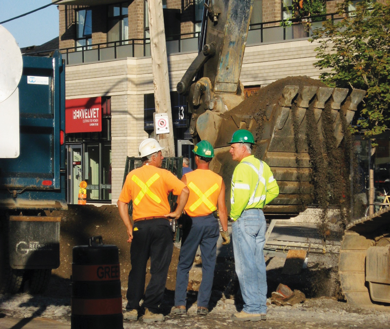
How can a natural gas pipeline, just a few tens of miles long, produce more headaches, frustration, delays and public opposition – and cost more – than a line of a few hundred miles? It can if that line is in a congested, urban environment.
Learning how to embrace the complexity involved in urban pipeline routing is the key to success for many distribution pipeline system operators.
This is because the worldwide growth of cities is causing them to be denser and more compact, with many competing demands on the available space. Yet, those city dwellers also want access to cheap and reliable natural gas, so utilities must provide service where they want it.
Another worldwide problem is that many of the gas distribution systems in city centers are undersized and antiquated – “legacy” systems that may date back to the 1950s or even before. They weren’t designed for the service life being asked of them. Many may have stress corrosion issues and other factors that can put the public at increased risk of a leak, or even explosion.
So, there is increasing need for new, replacement gas pipelines, 20 inches or more in diameter, squeezed into tight spaces that are already crowded with other utilities and aboveground uses as roadways, pedestrian and bicycle routes, green spaces and other purposes.
Experience with urban pipelines has found that success involves a new, inclusive way of planning, backed by current information technology. The good news is that the principles that work for large-diameter lines under cities can also make pipeline construction easier in more open areas.
Leaving the silo
One of the barriers to successful urban pipelines comes from the traditional structure of many organizations, including pipeline operators: the corporate silo.
Usually, the first designs of a pipeline route come from engineers, who select a route that is as straight, constructible and low-cost as possible. Then they pass that design, optimized for its technical aspects, over to permitting to obtain approval from municipal and other authorities.
The permitting people generally shake their heads because they know that city public works department and elected officials will never approve certain aspects of the route selected. This might be because construction will involve too much traffic congestion, disturbance of green space or conflict with other underground utilities. Other regulatory authorities, at other levels of government, also have requirements the project must meet.
After some back-and-forth, a compromise route is selected that is expected to be buildable and able to obtain regulatory approval. The plan then gets passed on to a third silo, which is responsible for engaging with the public and other key stakeholders, to hopefully gain support for the project – or at least prevent public opposition from stopping or slowing the work.
These people, in turn, shake their heads over what they’ve been given to work with, because they see elements of the routing that will be flash points for public opposition. They point these problem areas out and, eventually, routing and work plans slowly and painfully evolve.
Each of those three functions – technical, regulatory and environmental, and socioeconomic – has its own priorities. From the perspective of other disciplines, they are not even speaking the same language. Optimizing for one might well result in choices that would be unworkable for the other two functions.
What’s needed is a plan that all parties involved can, even if reluctantly, support. We have found the best approach is a process that breaks down those silos to develop a solution that avoids hard stops that make a pipeline impossible.
Even in an age of instant communications and shared databases, there are still huge benefits to bringing together representatives of all stakeholder groups into a single room, preferably in-person, so they can provide their perspective and expertise, and point out what’s unworkable about a possible route.
This can include people from engineering, permitting, social engagement, environmental, customer relations, marketing and other divisions within the organization. There may also be need for external expertise, such as in consulting archaeology and indigenous people.
Each representative shares concerns and priorities about route selection. Facilitators record these concerns and attach a weighting factor to each. Sometimes it takes two or three meetings to uncover all the issues.
Use technology
Current information technology can take the input from those meetings to better understand the factors at work. For example, the technical function may like the idea of a long, straight route, as it can be optimal for horizontal directional drilling. If this design also works for the other functional areas, that might be a routing option that gets chosen.
Many pipeline route planners like the idea of using existing roadways, because most customers will be located beside a road or street, particularly in an urban environment. But this might not be constructible because the space under the roadway is already packed tight with sewers, water mains, fibre optic cable and other utilities.
Software is available that uses geographic information systems (GIS) data to factor in a wide range of spatial and 3-D considerations, including existing utilities, land uses, topography, watercourses, natural habitat and parkland. Values are assigned to each of these factors. A park might be a complete “no-go” area, for example, while a stretch of roadway without many other utilities underneath it might be considered a strong “attractant” for the pipeline route.
This software then uses a “quadruple bottom line” approach – environmental, technical, regulatory and social factors – to evaluate the desirability of various options and trade-offs, to find the optimal solution. The result is a transparent process, easily understood by all stakeholders, that helps determine the best – or least-bad – choices in pipeline routing.
All the hard data, including technical and nontechnical risks, give project proponents something credible and transparent to use not just in costing the project, but in understanding the constraints on building it. For example, a cut-and-cover section in a roadway might have to be carried out only at night, and the work covered over with steel plates each morning before commuter traffic starts to build. This aspect needs to be factored into the financial budget, timeline and work plan.
Network of possibilities
One of the growing areas of focus in pipeline route planning is the idea that the choices do not form a single line, or are even among several possible, competing routes. Rather, potential routes together may comprise a network of individual sections meeting at nodal points on a map.
If a segment between two nodes is found to be problematic due to some constraint, another route can be chosen. This means that planners can assemble a best-possible route, combining the most workable segments between nodes, to meet the purpose of the pipeline.
The objective is to maximize “optionality” – generate a wide range of options, all pre-screened for quadruple bottom-line factors – partly to demonstrate to all involved that every practical alternative has been considered, and to allow the best combination of segments to emerge.
Project ‘de-risking’
One of the trends in large projects today is a greater and earlier role for stakeholder consultation.
Experience has shown that people affected by urban pipeline projects take a keen interest in the work and how it will be done, often because they live, work or play nearby. It’s their roads that will be torn up for pipeline installation, and they will be affected by the noise of construction equipment. On the other hand, these people are also aware that the buildings they use would be uninhabitable in the winter without access to natural gas, so they are willing to put up with the disruption – as a necessary evil.
Face-to-face meetings and presentations, open houses and other in-person communications are desirable. The proponent’s message can be spread further by current information technology. Interactive informational kiosks set up in the meeting area can provide information on the project, the routing choices under consideration, and public invitations for the community to give feedback. Websites and apps can support this process, or even replace it if in-person sessions are not feasible.
Stakeholders can try out various scenarios by changing the weights assigned to aspects of the project. They can consider the advantages of faster completion, for example, that might involve more road closures, versus a longer schedule that will have less impact on traffic.
Sometimes, there are win-wins, such as having the project proponent add some high-quality green space to be completed after the pipeline is installed.
This focus on public consultation can help “de-risk” the project. By providing a forum for identifying and voicing opinion, public protest is less likely. For all operators, risk and delay equal unnecessary cost that may otherwise have been avoided.
This process for pipeline route planning helps uncover no-go areas from any perspective. It also helps uncover “caution” areas, such as those for which strategic public engagement is particularly important, or where studies may need to be done to determine the pipeline’s impact.
The result is a route that is workable from all perspectives and can be built relatively quickly, because potential problems have already been discovered and risk management steps taken. •
Kevin Seel is senior consultant and project director with Golder. He holds a Ph.D. in geographic information systems and modeling from the University of Calgary.

Comments